
About Us
Historical Background
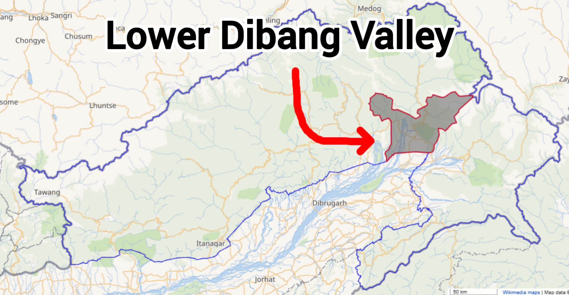
Lower Dibang Valley District, situated in the eastern region of Arunachal Pradesh, officially became operational on 16th December 2001, emerging as the 15th district of the state. It was created through the bifurcation of the erstwhile Dibang Valley district, with Roing established as its administrative headquarters. Named after the Dibang River flowing through the region, the district's formation represented an important administrative milestone, enabling more focused governance, efficient public service delivery, and targeted regional development benefiting local communities.
Location and Boundaries
Lower Dibang Valley District is located in the northeastern part of Arunachal Pradesh, India. It shares its northern boundary with Upper Dibang Valley District, while to the east, it borders the state of Assam. To the south and west, it is flanked by East Siang and Lohit districts, respectively. The district’s strategic position fosters cultural and economic interactions between Arunachal Pradesh and Assam.
Topography
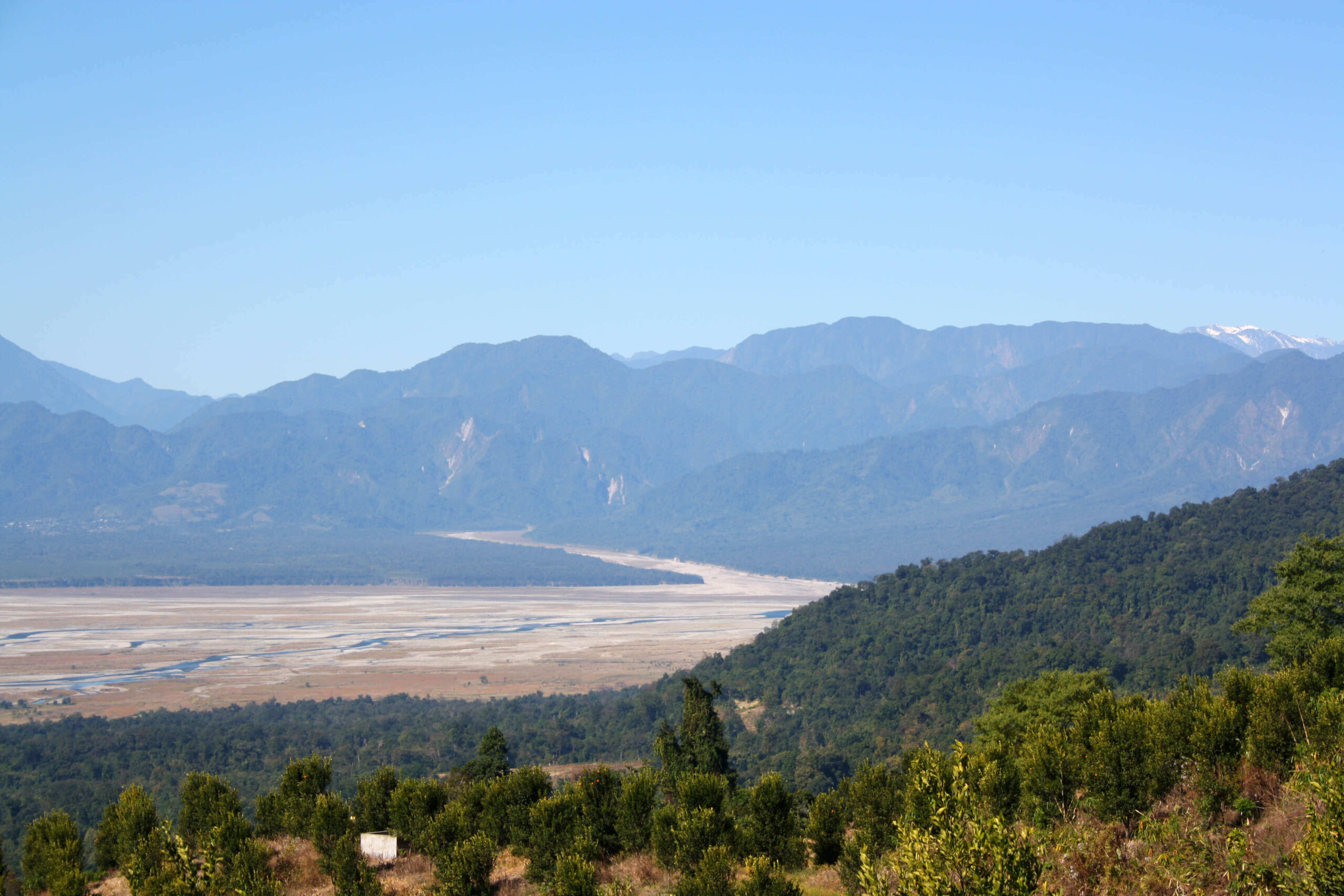
The district’s terrain is predominantly mountainous, characterized by undulating rugged mountains, deep gorges, and lush green valleys. Elevations range from approximately 114 meters to over 5,000 meters above sea level, with an average elevation of around 1,412 meters. This diverse topography supports rich biodiversity, including dense forests and numerous rivers and streams, such as the Dibang, Deopani, Ithu, Eze, Iphi, Aba, Chifu, Sisiri, and Dotung. These natural features offer immense potential for ecotourism and horticultural activities.
People
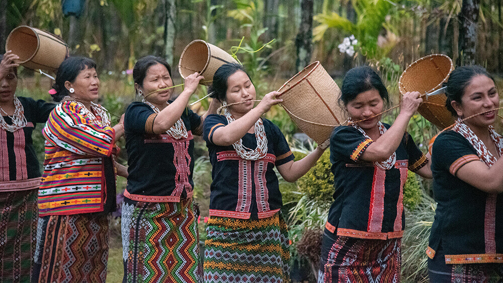
The Idu Mishmi tribe is the predominant ethnic group in Lower Dibang Valley district, Arunachal Pradesh. Renowned for their vibrant culture and unique traditions, the Idu Mishmis have preserved their age-old customs through festivals, traditional rituals, and distinctive social practices. One of the major festivals celebrated annually is 'Reh', held during the month of February. During Reh, traditional songs, dances, and offerings are performed to invoke the blessings of nature and ancestral spirits for prosperity, good harvests, and community well-being.
River Systems
Lower Dibang Valley District is traversed by several significant rivers that play a vital role in shaping the district’s ecology, economy, and cultural heritage. The Dibang River, originating near the Keya Pass close to the Indo-China border, is the district’s main river, flowing through diverse terrains before joining the Lohit River near Sadiya in Assam. The Dibang is enriched by numerous tributaries, including Emra, Ithun, Eze (also known locally as Deopani), Iphi, Aba, Chifu, Sisiri, and Dotung rivers. Together, these rivers form an extensive network of waterways, nurturing rich biodiversity and fertile agricultural lands. The rivers provide indispensable resources, supplying irrigation water essential for farming and sustaining local food security. They also serve as vital sources of drinking water, supporting the day-to-day lives and health of communities across the district.
Beyond practical uses, these rivers hold immense cultural and spiritual significance. Community life, rituals, traditional festivals, and folklore often revolve around these waterways, highlighting their integral role in the local culture. The rivers also contribute to local economies through fisheries and sustainable tourism activities, attracting nature enthusiasts and researchers. Additionally, during monsoon seasons, these rivers experience substantial water flow, influencing agricultural cycles, soil fertility, and local livelihoods. Overall, the river system in Lower Dibang Valley District symbolizes the harmony between nature and human society, playing an indispensable role in ecological balance, cultural identity, and sustainable development.
Flora and Fauna
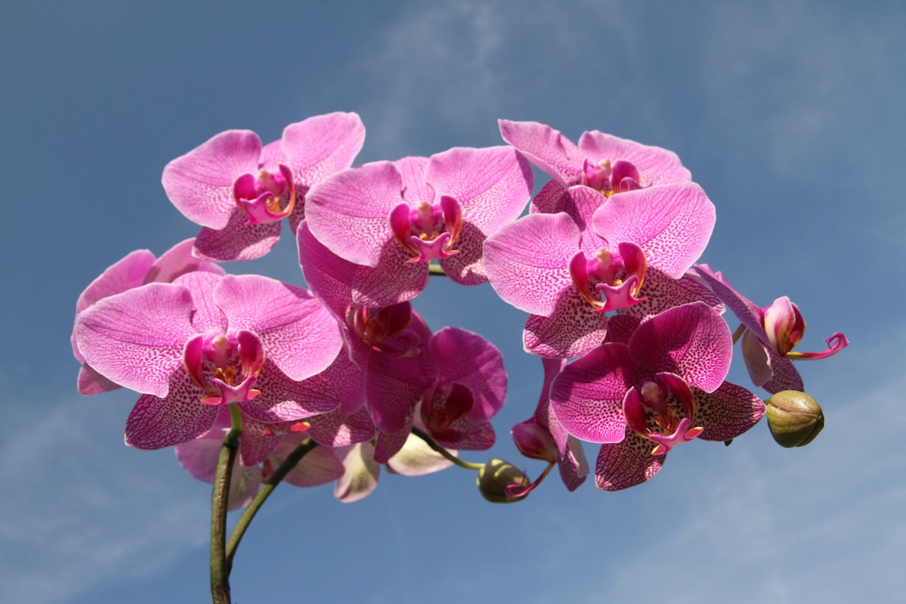
Lower Dibang Valley District, part of the Eastern Himalayan Global Biodiversity Hotspot, boasts a rich tapestry of flora and fauna. The district's forests transition from tropical evergreen at lower elevations to subtropical and temperate varieties at higher altitudes, supporting a diverse range of plant species. Notably, the region is home to valuable timber species such as Hollock (Terminalia myriocarpa), Khokan (Duabanga grandiflora), Mekai, Simul, Titachampa (Michelia champaca), and Gamari (Gmelina arborea). Additionally, the area is abundant in bamboo (Dendrocalamus hamiltonii) and various cane species, which are integral to local livelihoods and crafts. Protected areas like the Mehao Wildlife Sanctuary, spanning 281.5 square kilometers, play a crucial role in conserving this biodiversity.
Population and Administration:
According to the 2011 Census, Lower Dibang Valley District has a total population of 54,080 individuals, comprising 28,053 males and 26,027 females. The district’s administrative framework is organized into three subdivisions—Roing, Hunli, and Dambuk—and seven circles: Roing, Koronu, Parbuk, Hunli, Desali, Dambuk, and Paglam. This structure facilitates efficient governance and development at the grassroots level. Roing serves as the administrative headquarters, housing key governmental offices and public facilities that cater to the needs of the district’s residents.
Climate:
Lower Dibang Valley District experiences a subtropical climate, significantly influenced by the region’s varied topography and altitude. The climatic conditions vary distinctly across the district, ranging from humid and warm in the valleys to cool and temperate at higher elevations. The area witnesses heavy annual rainfall, particularly concentrated between March and August, with precipitation recorded at approximately 6,642.32 mm in a typical year such as 2012. Summers in the district, especially in lower-altitude regions like Roing, can be notably warm, with May temperatures often reaching as high as 35.5°C. Conversely, higher-altitude regions, including Hunli and Desali circles, experience more moderate summer temperatures and considerably colder winters, sometimes accompanied by snowfall and frost. These sharp climatic variations greatly impact local agriculture, dictating cropping cycles and agricultural practices. Additionally, the diverse climate supports a rich biodiversity, providing habitats for numerous plant and animal species adapted to distinct environmental niches. Overall, the district’s climate profoundly shapes the lifestyles, cultural practices, and economic activities of its inhabitants, fostering a strong relationship between the local communities and their natural environment.